Archaeo GIS
The requirements for the ‘ArchaeoAnalyst’ software have been specified. ‘ArchaeoAnalyst’ is the name of a GUI- and Wizard-based extension to ArcGIS 10.1 and later versions, developed by the LBI ArchPro for internal use only, collecting and combining tools for data import, dynamic visualisation, interpretation, spatial analysis and mapping in a way optimally suited for LBI ArchPro projects.
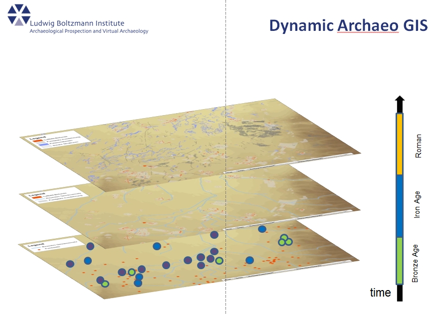
A project started with ‘ArchaeoAnalyst’ and its contained data shall be properly geo-located from the beginning, metadata correctly entered, and a homogeneous project structure will simplify and help avoiding errors and confusion when working inside the various case study areas. The LBI ArchPro collects data from different sources: Magnetics (different measurement systems), Ground Penetrating Radar (GPR; different measurement systems), Airborne Laser Scanning (ALS), Terrestrial Laser Scanning (TLS; Time-Of-Flight and Structured-Light systems), and conventional, multichannel and hyper-spectral aerial photography. All source data and images are visualized and interpreted individually or in combination. Combinations of different raster images of different sources created on-the-fly shall allow the integrated interpretation of data. For supporting standardized output, mapping shall be supported with homogeneous presentation of equal features, meaningful legends, scale, grids, credits etc.